A red light camera map helps you see automated enforcement locations before you reach an intersection, but the best source depends on where you are driving. In the United States, camera programs are controlled by state and local law, so the most reliable approach is to check the local transportation department, police department, court or open data portal before your trip.
This guide presents general information. Check current official road rules and follow every posted sign.
How to use a red light camera map before a trip
Start with the agency that runs the road. For a city street, look for the city transportation department or police automated enforcement page. For a state highway, work zone or parkway, check the state department of transportation or highway safety office. Federal agencies do not operate red light cameras, and the Federal Highway Administration says questions about tickets, citations and local systems should go to local or state police, traffic engineering or public works agencies.
Many official camera pages are not called maps. They may be labeled automated traffic enforcement, photo enforcement, traffic safety cameras, red light camera enforcement, safe driving, Vision Zero or open data. A useful page should identify the type of camera, the intersection or street segment, and the direction of travel being enforced. Some cities publish an interactive map, while others publish a PDF list or a downloadable dataset.
Use the map before driving, not while you are moving. If you use the Speed Camera Radar Detector app, set up alerts and review your route before you start so it supports safer awareness without becoming a distraction behind the wheel.
- Search by city or county name
- Check the official transportation or police page
- Look for the enforced approach or direction
- Review the route before you drive
- Keep your attention on the road
Why red light camera locations vary so much
There is no single national rule for red light camera locations. Some states authorize them statewide, some limit them to specific cities or corridors, and some prohibit or do not specifically authorize them. Even where cameras are allowed, the local program may cover only selected intersections with a documented crash history or repeated red-light running problem.
A red light camera is usually tied to a specific signalized intersection and a specific approach, such as northbound, westbound or a right-turn lane. That detail matters. A camera at one corner of an intersection may not monitor every direction of travel. San Francisco, for example, publishes red light camera locations by intersection and direction, and notes that one location enforces a posted no-right-turn movement rather than a standard through red-light violation.
Camera lists can change when equipment is upgraded, contracts end, construction affects signal equipment or a city expands its program. Treat any map as a planning tool, not a guarantee. Signs, signals, pavement markings and the posted law at the road always matter more than a pin on a map.
- State law controls whether cameras are allowed
- Local agencies choose specific sites
- An intersection may have only one enforced approach
- Programs can expand, pause or be removed
- Posted signs and signals control the drive
Red light cameras, speed cameras and school-zone cameras are different
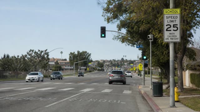
A red light camera records vehicles that enter an intersection after the signal has turned red. A speed camera records vehicles traveling above the posted speed limit. Some programs also use stop-sign cameras, bus-lane cameras, toll cameras, railroad crossing cameras or work-zone speed cameras. A map that shows one type may not show the others.
If you are looking for speed camera locations, use a speed camera map or the local agency’s speed safety camera page. Chicago, for example, publishes a speed camera locations dataset with addresses, operational dates and approaches. Washington, DC publishes an automated traffic enforcement location list that includes red light enforcement, speed enforcement, stop signs and oversized vehicles. These are different categories, even when they appear on the same local enforcement page.
Do not assume every camera over a road is an enforcement camera. Many devices near intersections are traffic signal sensors, travel-time readers, weather sensors, security cameras or traffic monitoring cameras. Enforcement camera pages usually describe the violation type and the location. If an official page does not identify a device as an enforcement camera, it may not issue citations.
- Red light cameras: signal violations
- Speed cameras: posted speed violations
- Work-zone cameras: temporary or mobile enforcement
- Stop-sign cameras: stop compliance
- Traffic cameras: often monitoring only
Where official maps usually appear
Large cities often publish camera data through open data portals. These may offer map views, CSV files, KML files or GeoJSON files that can be used in mapping software. Open datasets are useful because they may include coordinates, addresses, approaches and update dates, but they can also be technical and may not explain citation rules in plain language.
Transportation department pages are often easier for drivers. They may list the current intersections, describe why sites were chosen and explain warning periods or citation processing. San Francisco’s SFMTA page, for example, explains that red light camera placement is based on public safety and prioritizes intersections with high collision totals. It also separates currently enforced approaches from planned expansion locations.
State highway safety office pages are useful when you need to know whether a state permits or limits automated enforcement. They are not always location maps. If a state page gives only legal background, move next to the city, county or local police page for the actual red light camera locations or speed camera locations.
- City transportation department pages
- Police automated enforcement pages
- Open data portals
- State DOT work-zone pages
- Court or citation payment pages
How to read a camera map correctly
A good camera map should tell you more than a dot on a street. Look for the enforced movement, such as southbound left turn, eastbound through lanes or right turn on red. Look for whether the location is active, planned, under construction or historical. If the map was last updated months ago, compare it with the agency’s current automated enforcement page.
Be careful with third-party maps. They can be convenient for route planning, especially across city lines, but they may combine official data, user reports and older records. A pin may mean a documented location rather than a currently active camera. When a ticket, legal deadline or dispute is involved, rely on the notice you received and the local court or agency instructions, not a general map.
Also remember that camera laws and penalties vary widely. In some places, automated camera citations are civil penalties mailed to the registered owner. In others, points, owner liability, driver identification, warning periods and fine amounts are handled differently. This article is educational only and is not legal advice.
- Check active versus planned status
- Confirm the enforced direction
- Look for the update date
- Separate official data from user reports
- Follow the notice if you receive one
Safe driving matters more than any map
A red light camera map is most useful when it helps you anticipate complex intersections and drive calmly. It should not be used to brake late, accelerate through yellow lights or change lanes suddenly near a camera. Sudden reactions can increase rear-end and side-impact crash risk, especially at busy urban intersections.
The safer habit is simple: approach signalized intersections ready to stop, obey posted speed limits, avoid blocking crosswalks and give yourself enough following distance. For speed enforcement areas, use the posted speed limit as your reference, not surrounding traffic. In school zones, work zones and high-injury corridors, expect enforcement locations to change as agencies respond to crash patterns and construction schedules.
If you are driving in an unfamiliar city, review camera information while parked or before departure, then let the road signs and signals guide you. Maps and alerts are planning aids. They do not replace careful observation, local traffic law or the duty to drive safely.
A simple pre-drive checklist
- Set the route and alerts before moving.
- Check the first posted limit after every major turn.
- Leave enough space to adjust without abrupt braking.
- Use official sources when a rule affects your licence.